Email: sales@eugnss.com Tel: pls whatsapp us
Email: sales@eugnss.com Tel: pls whatsapp us

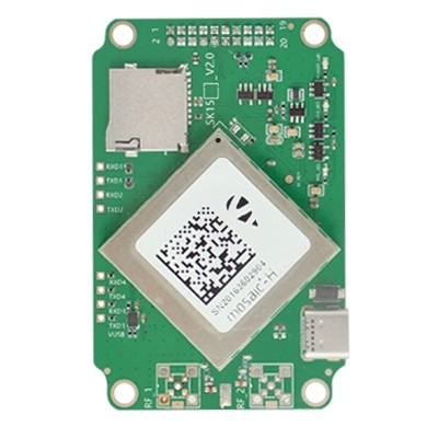
Home M68
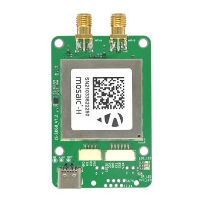
Multi-band, multi-constellation satellite receiver, with a variety of data interfaces.
Product IntroductionM68 High Precision Board - Receiving Satellite (Mosaic-x5 single antenna)
| Satellite System | Signals |
|---|---|
| GPS | L1C/A, L1C, L1PY, L2C, L2P, L5 |
| BDS | B1I, B1C, B2a, B2I, B2b, B3I |
| GLONASS | L1CA, L2CA, L2P, L3 CDMA |
| Galileo | E1, E5a, E5b, E5 AltBoc, E6 |
| QZSS | L1C/A, L1C/B, L2C, L5 |
| SBAS | EGNOS, WAAS, GAGAN, MSAS, SDCM (L1, L5) |
| Extra | L5 |
Receiving Satellite (Mosaic-H dual antenna)
| Satellite System | Signals |
|---|---|
| GPS | L1C/A, L2P(Y), L2C |
| BDS | B1, B2I, B3I |
| GLONASS | L1C/A, L2C/A |
| Galileo | E1, E5b |
| QZSS | L1C/A, L1C/B, L2C |
| SBAS | EGNOS, WAAS, GAGAN, MSAS, SDCM (L1) |
Technical Specifications:
| Parameter | Value |
|---|---|
| Elevation accuracy (RTK status) | 1cm+1ppm |
| Horizontal position accuracy | 0.6cm+0.5ppm |
| Tracking and navigation sensitivity | 20 dB-Hz |
| Acquisition sensitivity | 33 dB-Hz |
| Timing accuracy (xPPS) | 5 ns |
| Cold start | 45 s |
| Warm start | ≤20 s |
| Re-acquisition | 1 s |
| Tracking channel | 448 |
| Acquisition channel | 448 |
| Velocity accuracy | 3 cm/s |
| Directional accuracy (1m antenna pitch) | Heading: 0.15°, Pitch/Roll: 0.25° |
| Directional accuracy (5m antenna pitch) | Heading: 0.03°, Pitch/Roll: 0.05° |
| Dynamic limitation | ≤ 4 g |
| Height restriction | 18000 m |
| Speed limit | 515 m/s |
| Refresh frequency | 115200-4M bps (default: 115200bps) |
| Navigation update frequency (orientation) | 100 Hz |
| Navigation update frequency (observed value) | 100 Hz |
| Max update frequency (Standalone, SBAS, DGPS) | 50 Hz |
| Max update frequency (RTK) | 20 Hz |
| Operating voltage/current | 3.3V~5.5V / 3.3V@210mA |
| Weight | 16 g |
| Dimension | 71.0×46.0×11.3 mm±0.3 mm |
| Interface type/number | USB(1), UART(2) |
| Service temperature | -40℃~85℃ |
| Storage temperature | -55℃~85℃ |
Product Applications